National Capital District (National Capital District)
The National Capital District of Papua New Guinea is the incorporated area around Port Moresby, which is the capital of Papua New Guinea. Although it is surrounded by Central Province, where Port Moresby is also the capital, it is technically not a part of that province. It covers an area of 240 km2 and has a population of 364,125 (2011 census). It is represented by three open MPs and an NCD-wide representative in the National Parliament of Papua New Guinea who acts as Governor of the National Capital District; however, these MPs do not have the same powers as elsewhere in the country due to the role of the National Capital District Commission.
The National Capital District did not have a decentralised administration with a Premier, as with the other provinces, prior to 1995; however, since the 1995 reforms of provincial governments it has been headed by a Governor, albeit one with more limited powers.
The National Capital District did not have a decentralised administration with a Premier, as with the other provinces, prior to 1995; however, since the 1995 reforms of provincial governments it has been headed by a Governor, albeit one with more limited powers.
Map - National Capital District (National Capital District)
Map


Country - Papua_New_Guinea
 |
 |
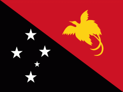
| Flag of Papua New Guinea | |
At the national level, after being ruled by three external powers since 1884, including nearly 60 years of Australian administration starting during World War I, Papua New Guinea established its sovereignty in 1975. It became an independent Commonwealth realm in 1975 with Elizabeth II as its queen. It also became a member of the Commonwealth of Nations in its own right.
Currency / Language
| ISO | Currency | Symbol | Significant figures |
|---|---|---|---|
| PGK | Papua New Guinean kina | K | 2 |
| ISO | Language |
|---|---|
| EN | English language |
| HO | Hiri Motu language |
